Hyperlocal Air monitors with mobile, stationary, wearable, and robotic sensors ground truth data of air quality and greenhouse gases and turns these data into actionable information to better understand air pollution and help cities, citizens, and companies to take action for a more sustainable future with reduced emissions for better public health and a lower climate impact.
Ground Truth Data
We monitor with mobile, stationary, wearable, and robotics sensors ground truth data of air quality and greenhouse gases, where people live, play, and work
End-to-end Air Intelligence Cloud
Our dedicated cloud software for monitoring, visualizing, and diagnosing air pollution is enabling data-driven decision making and the management of air pollution in near to real-time.
Advanced Data Analytics, AI, machine learning
Our deep analytics are powered by advanced analytical technologies and machine learning algorithms, including neural networks and ensemble methods, generating actionable data for decision-makers.
Third Party data integration
We integrate and build on top of existing satellite and sensor data and augment the spatial resolution of traditional approaches up to 100.000 times with our complementary ground truth data.
Track multiple pollutants at once
Monitor, track and analyse a wide variety of pollutants such as Benzene, Toluene, Ethylbenzene, m-Xylene, o-Xylene, p-Xylene, Ozone, Nitric Oxide, Sulphur Dioxide, Nitrogen Dioxide, Styrene, Ammonia, Formaldehyde, 1,3-Butadiene, particulate matter (ranging from 1 to 10µm) and Black Carbon
Supercharge Clean Air Solutions
Gain comprehensive visibility and enable mitigation actions to tackle air pollution with our dedicated cloud clean air management tools that enable data-based decision making and near to real-time management of air pollution hotspots and events.
Standard Air sensing
VS

Hyperlocal Air sensing
It’s hard to tackle problems you can’t really see.
Air pollution can be hard to see, so it is challenging for local entities to pinpoint sources and patterns to develop effective solutions.
Conventional air pollution management, which commonly relies on a few fixed monitors and modeling with a few data points, is typically being used in Europe and around the world among other punctual scientific initiatives.
This approach measures air quality in high levels of accuracy however, by their very nature, stationery, they are fixed and only measure air pollution and particulates in one location. Due to the high costs, cities install only a small number of them. This approach provides a good picture of pollution over time, but as different scientific studies have shown, stationary sensors can significantly mischaracterize pollution just a hundred meters away.
What is not measured cannot be understood nor managed.
Due to the limitations of conventional air quality monitoring and the complexity of urban or industrial sites, new technology must be used to assess the air pollution impact of these facilities and support decision-makers.
Key improvements in high-resolution mobile air monitoring, data management, and above all analysis techniques represent today an effective technique to spatially and temporally characterize air pollution in areas near sources.
We at Hyperlocal Air have built on the latest science and technology advances and have created an integrated mobile high-definition air pollution monitoring platform in conjunction with dedicated cloud software for monitoring, visualizing, and diagnosing air pollution.
Our Hyperlocal Air approach allows us to measure and map air pollution street-by-street, we set a data node every 30 meters, at a hyperlocal scale. This means gathering very large amounts of air quality data at a resolution significantly higher than conventional stationary air pollution monitoring.
We sense with up to 100,000 times greater spatial resolution than traditional air monitoring approaches.
Unlike conventional air pollution monitoring, we can track multiple pollutants at once using the most advanced high-tech sensors.
Hyperlocal Air tracks with high precision and as from low concentrations in near to real-time:
Benzene, Toluene, Ethylbenzene, m-Xylene, o-Xylene, p-Xylene, Ozone, Nitric Oxide, Sulphur Dioxide, Nitrogen Dioxide, Styrene, Ammonia, Formaldehyde, 1,3-Butadiene, particulate matter (ranging from 1 to 10µm) and Black Carbon
Our Air Intelligence Cloud software processes millions of data points powered by advanced analytical technologies and machine learning algorithms, including neural networks and ensemble methods, generating actionable Air Intelligence data for decision-makers.
These high-definition pollution data help to identify where attention is needed most, better understand what’s causing pollution and then help tailor solutions to meet the most critical challenges.
With our Hyperlocal Air 360 ° approach we enable Industrial complexes and ports a much deeper understanding of air pollution patterns and pollution Hotspots with insights and management capabilities at previously unknown levels.
Hyperlocal Air – making the invisible visible.
The Hyperlocal Air 360° monitoring approach shifts air pollution monitoring from passive monitoring towards active management of air quality in near to real-time.
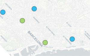
Urban areas – Cities
How data can supercharge efforts to lower air pollution in Cities
A century ago, roughly 10 percent of the world’s population lived in cities. Today, some 55% of the world’s population – 4.2 billion inhabitants – live in cities.
Urbanization is one of the most powerful, irreversible forces in the world. This trend is expected to continue. By 2050, with the urban population more than doubling its current size, nearly 7 of 10 people in the world will live in cities. Cities generate about 80 percent of global GDP today. The top 100 largest cities account for 35 percent of global GDP; Tthe top 600 cities are expected to generate 62 percent of global GDP;
Cities today are both the engines of innovation, economic growth, and tremendous economic activity but at the same time, they are a major source of pollution, emissions, dust, and noise.
The quality of the air we breathe affects all humans but especially the more than 4 billion people – more than half of the world – that live today in urban areas.
According to European Union (EU) data, the human toll for poor air quality is worse than for road traffic accidents, making it the number one environmental cause of premature death in the EU. Every year, more than 400 000 people in the EU die prematurely due to the consequences of air pollution. This is more than 10 times the toll of road traffic accidents.
Therefore, air pollution is an invisible killer: not just because we cannot always see it, but also because most of us are unaware of the widespread toll it takes, contributing to more than 7% of global deaths annually. The direct costs to society from air pollution, including damage to crops and buildings, amount to about €23 billion per year globally.
Finding better ways to fight air pollution in Cities is not an option, it is a must.
Hyperlocal scale advanced Data Analytics, AI, machine learning
Hyperlocal Air can contribute significantly to better understanding air quality in cities and to develop smarter actions for mitigating air pollution.
Our Hyperlocal Air 360° approach allows us to measure and map air pollution street-by-street, we set a data node every 30 meters, at a hyperlocal scale. Our high spatial resolution data in combination with our Air Intelligence Cloud provides deep analytics based on advanced analytical technologies and machine learning algorithms, including neural networks and ensemble methods, generating actionable data for decision-makers to enable smart solutions for better air quality in urban areas.
Reach out to us and learn how Hyperlocal Air can help you to tackle air pollution effects in your city.

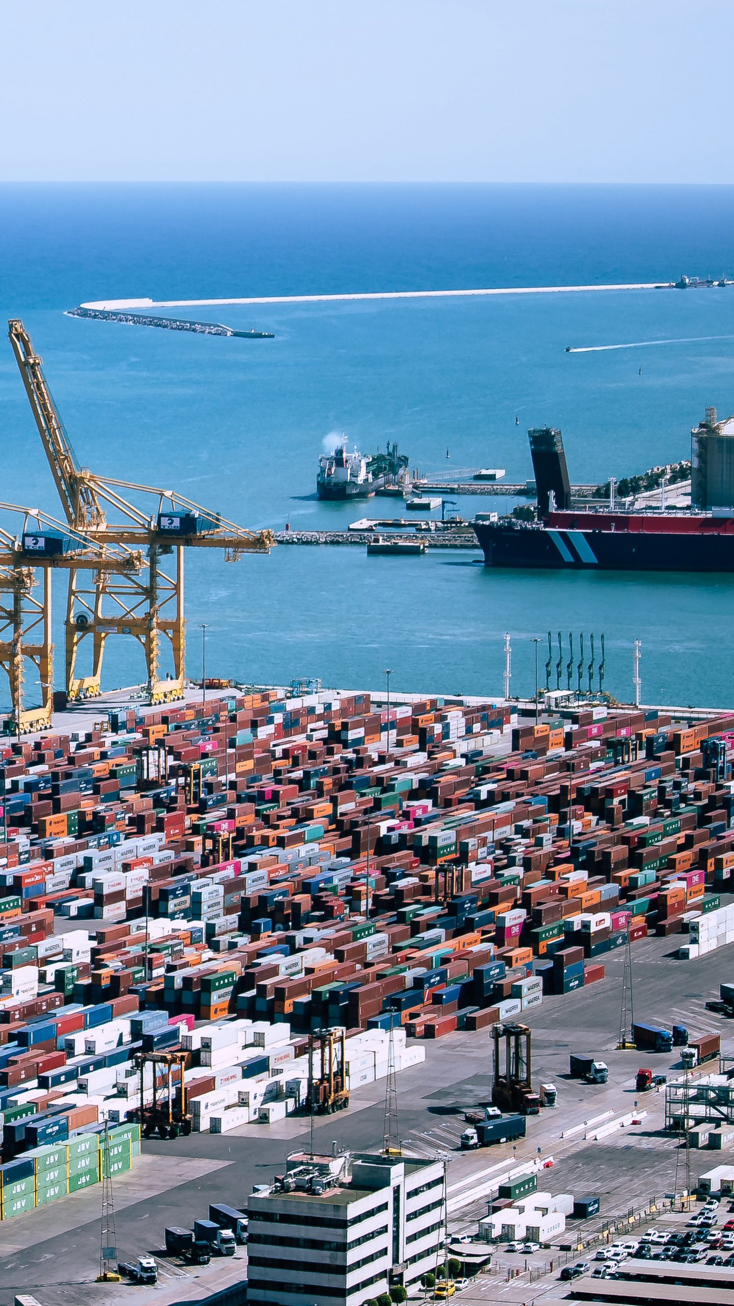
Industrial complexes and Ports
Ports are the gateways and transhipment hubs for international trade.
This globalization of trade makes maritime transport and ports a crucial sector of the world economy. Currently, over 80% of the world trade is carried by sea. Due to the ongoing increase in global trade, transport of a wide variety of goods through ports has been steadily increasing and will likely continue to increase in the future.
Ports are crucial infrastructure hubs of tremendous economic activity but they are also major sources of pollution, emissions, dust, and noise.
Ports are often located close to large urban areas, which gives ports additional responsibility for measuring and managing air pollution to mitigate in the best possible way the air pollution risk for millions of citizens.
Understanding the effect of port facilities on air quality is particularly difficult due to the inherent multimodal nature of the facilities.
With our Hyperlocal Air 360° approach we build on key improvements in high-resolution mobile air monitoring, data management, and above all analysis techniques and enable an effective technique to spatially and temporally characterize air pollution in areas near sources with data capture at a historically unprecedented scale, resolution, and quality.
Hyperlocal Air monitoring tackles the challenges of Air Pollution monitoring in port environments and tracks with high precision and as from low concentrations in near to real-time:
Benzene, Toluene, Ethylbenzene, m-Xylene, o-Xylene, p-Xylene, Ozone, Nitric Oxide, Sulphur Dioxide Nitrogen Dioxide, Styrene, Ammonia, Formaldehyde, 1,3-Butadiene, particulate matter (ranging from 1 to 10µm) and Black Carbon
With our Hyperlocal Air 360 ° approach we enable Industrial complexes and ports a much deeper understanding of air pollution patterns and pollution Hotspots with insights and management capabilities at previously unknown levels.
Hyperlocal Air – making the invisible visible.
Leadership Team

Joao Paulo Brito
CTO
BSc, MSc, Digital Technologist with 15+ years’ experience consulting for blue-chip enterprises and start-ups, identifying, implementing and enabling innovative technologies and systems, experience in a range of industries such as automotive, logistics, fast-moving consumer goods and robotics for clients such as Henkel, DB Schenker, Audi and RB.

Frank Gaugel
CEO
BSc, MSc, digital transformer, strategy consultant, an expert in digital transformation programs and enterprise software development with more than 20 years of experience managing large-scale blue-chip tech projects in the logistics, FMCG, Mobil telecom, and aerial robotics industries for clients such as DHL, DB Schenker, Deutsche Post, Henkel, and Schwarzkopf. Frank founded several companies; among others, Nightingale Security a successful Drone aerial robotics security and sensing start-up based in Silicon Valley.

Andreu Alibés, PhD
Chief Scientist, CSO
BSc, Ph.D. in Physics with 20 years of experience in Data Analysis, Bioinformatics, coding, web development, AI, and machine learning for different research Institutes: Spanish National Cancer Centre, Burnham Institute, Centre for Genomic Regulation, Institute for Biomedicine Research, IGTP.